Hogan Park: The Carry Emergency Survival Gear Ski Tour!
 Dire Warnings to the Unprepared!
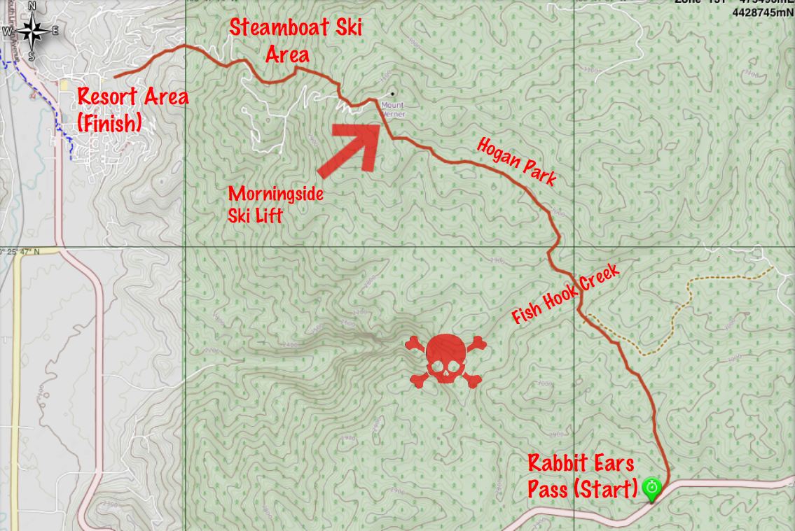
Ok, I’ve been too busy to post earlier this week but here is the latest. Last weekend we did the long Hogan Park backcountry ski tour near Steamboat. The trip starts at the Walton Peak parking area on Rabbit Ears pass and ends at the base of the Steamboat downhill ski area. It’s seven miles of mild up and down touring through the pine and aspen forest that ends at the base of the Morningside ski lift. From there you ride the lift up (the resort lets you ride once for free) and do the long downhill run to the base area. We then hired a taxi to take us back up to get our car at the top of the pass. Overall, the tour took about 6 hours. Click on the map below for a detailed view of our route.
The map shows the GPS track of the route. I used MotionX GPS app on my iPhone and it worked great. The cool thing about this particular app is that it allows you to download maps for use in the backcountry where you probably won’t see a cell site. Google, Bing and Apple don’t allow you to download maps, you need a cell or wifi connection to use their mapping applications.
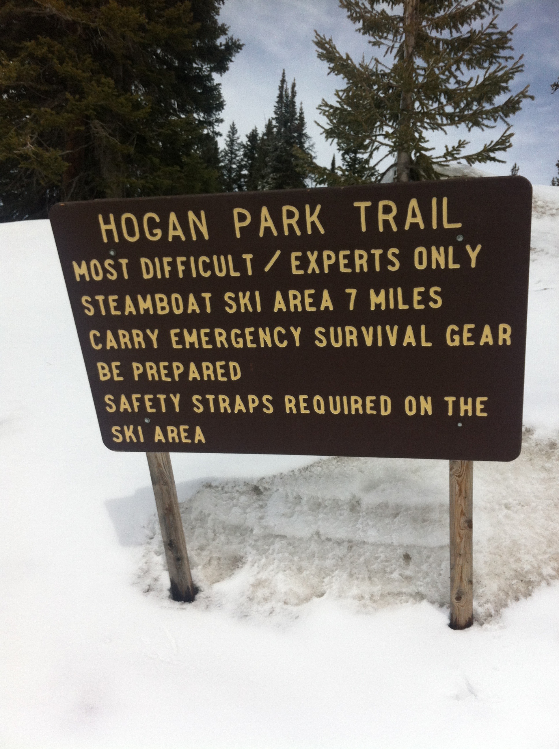
The map shows the area just to the southeast of Steamboat Springs. The resort area is in the upper left corner of the map. The downtown area of Steamboat is slightly off the map to the northwest. I labeled some of the interesting spots. The tour starts at the bottom right where you see the highway at the top of the pass. The first thing you see is the sign pictured at the start of this post warning that this is for “experts only!”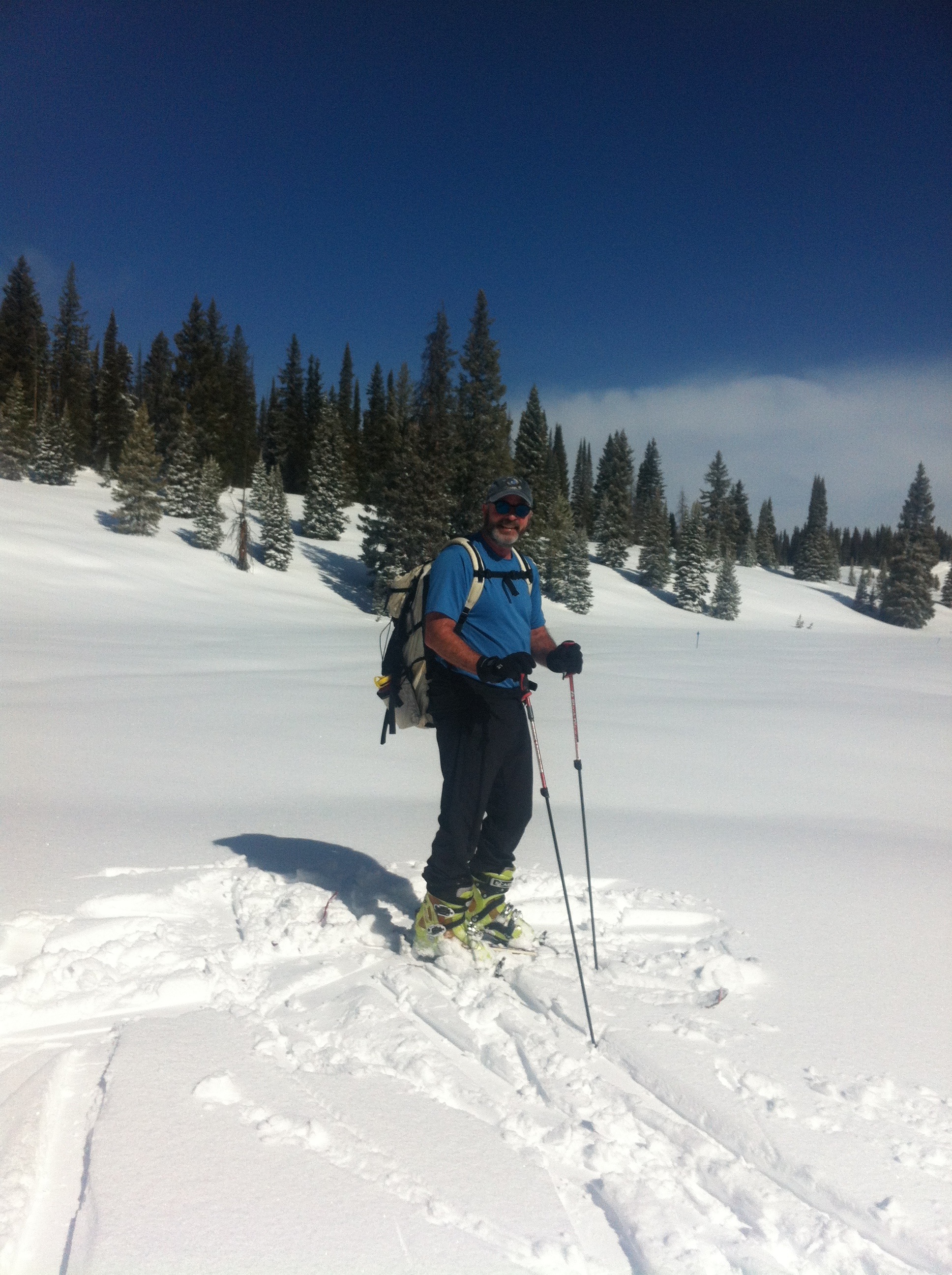
To me this kind of warning is a little over the top. It’s probably necessary though, given the nature of this route. I’m not sure you need to be an expert, but you certainly must take more care than the casual skier might. It’s not even close to difficult in terms of physical difficulty. There aren’t any super-steep or long climbs on the route, and it really isn’t that long. But those aren’t the only aspects to consider when in the mountain wilderness. The route is marked about every 50 feet by blue diamond signs, either nailed to trees or poles in the open field. Seems easy to follow, but the real difficulty here is navigation.
Several conditions combine in this area to make navigation tough. If you miss a blue diamond route marker, you have very little to help you with dead reckoning. Why? First is the “flatness” of the area. There just aren’t many visible landmarks to orient yourself. There is no overarching mountain visible like there is in most areas of Colorado. Also, the terrain seems to repeat itself as you wander: Hills covered with trees separated by wide open meadows, followed by the same.
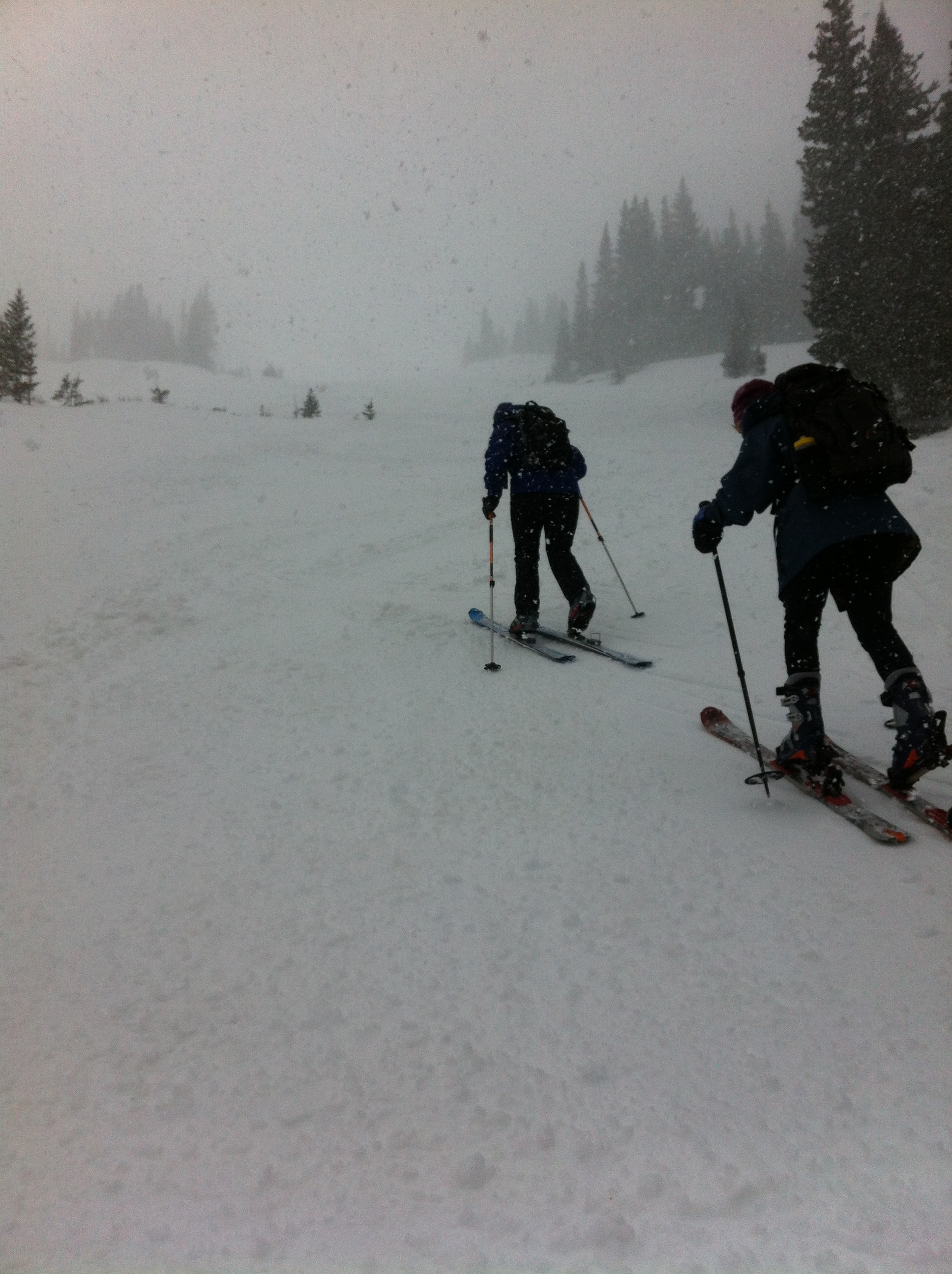
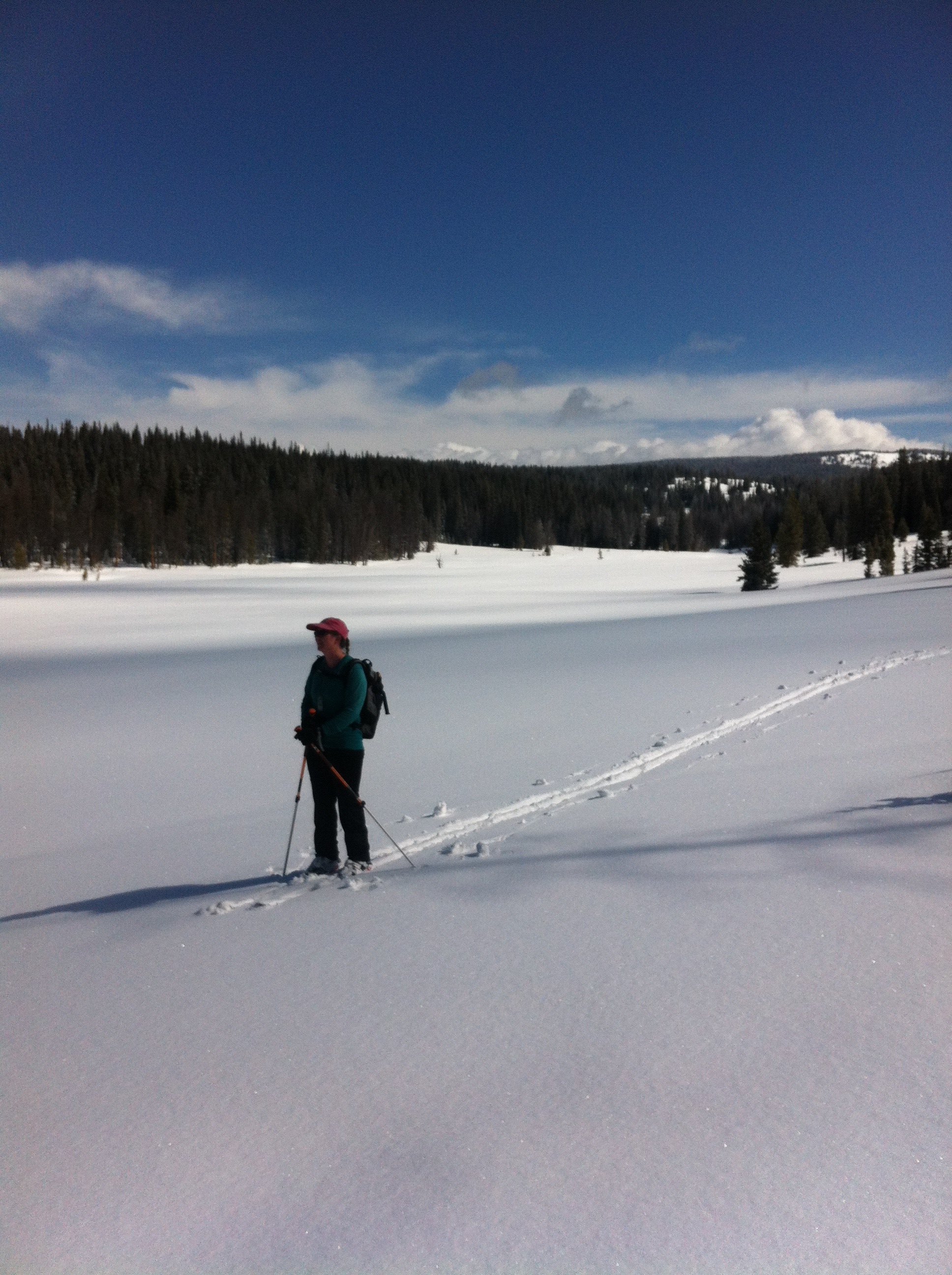 Add to this the notorious Rabbit Ears weather: Whiteouts seem to be much more common here than anywhere I’ve been in the state due to fog and snowfall. And it snows here more than you might expect. This tends to cover any tracks from previous skiers that you might follow. See the pics on the left and above right, the only tracks you can see were made by us.
The skull and crossbones on the map indicates the area where some lost skiers get into trouble. If you turn west too soon you run into an impossibly steep canyon. Skiers have gotten stuck, waited a freezing overnight and subsequently rescued in this impassible terrain. The reality is, navigation is not difficult, especially with the tools available today. You just have to be disciplined enough to do it. 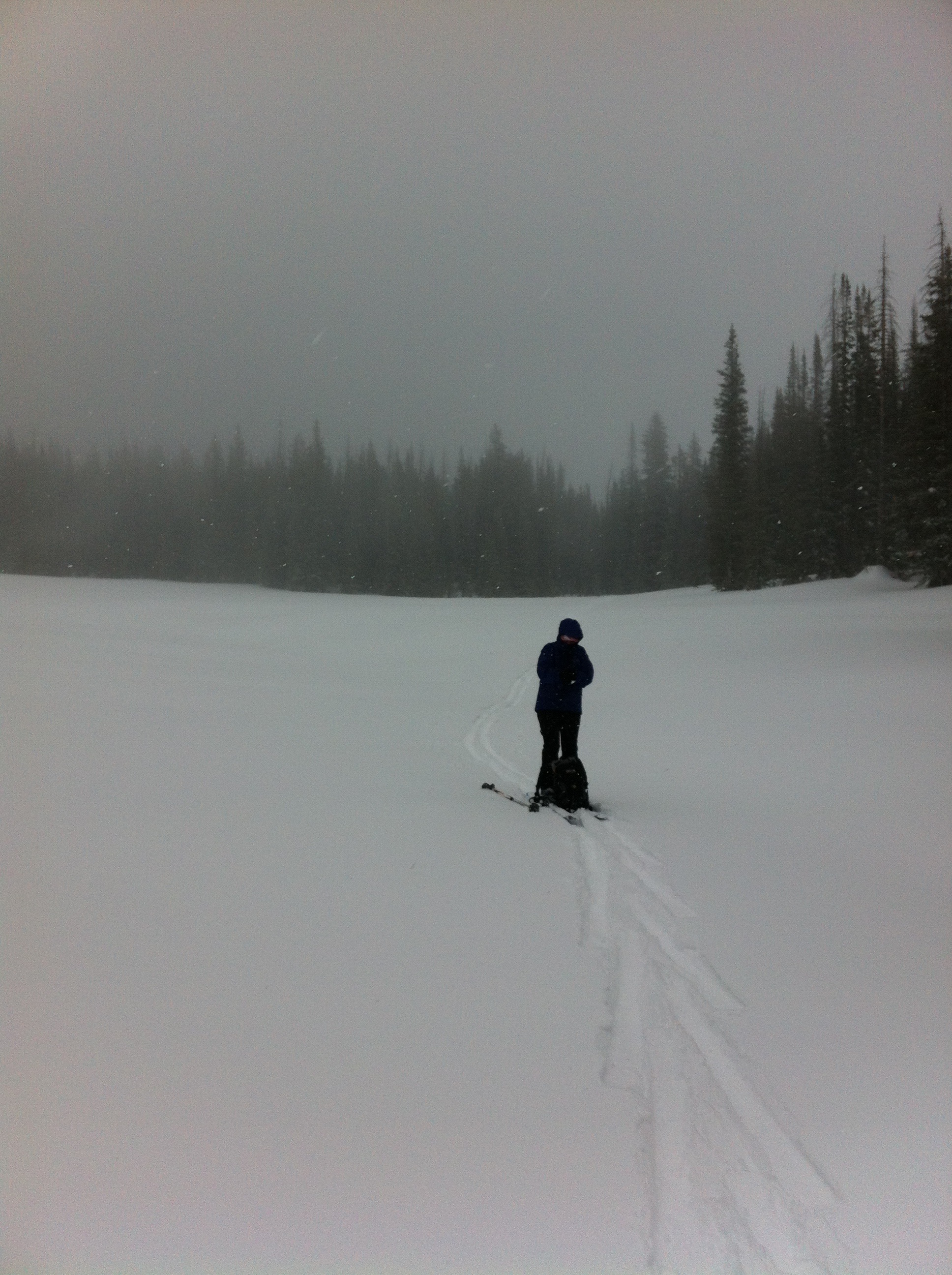
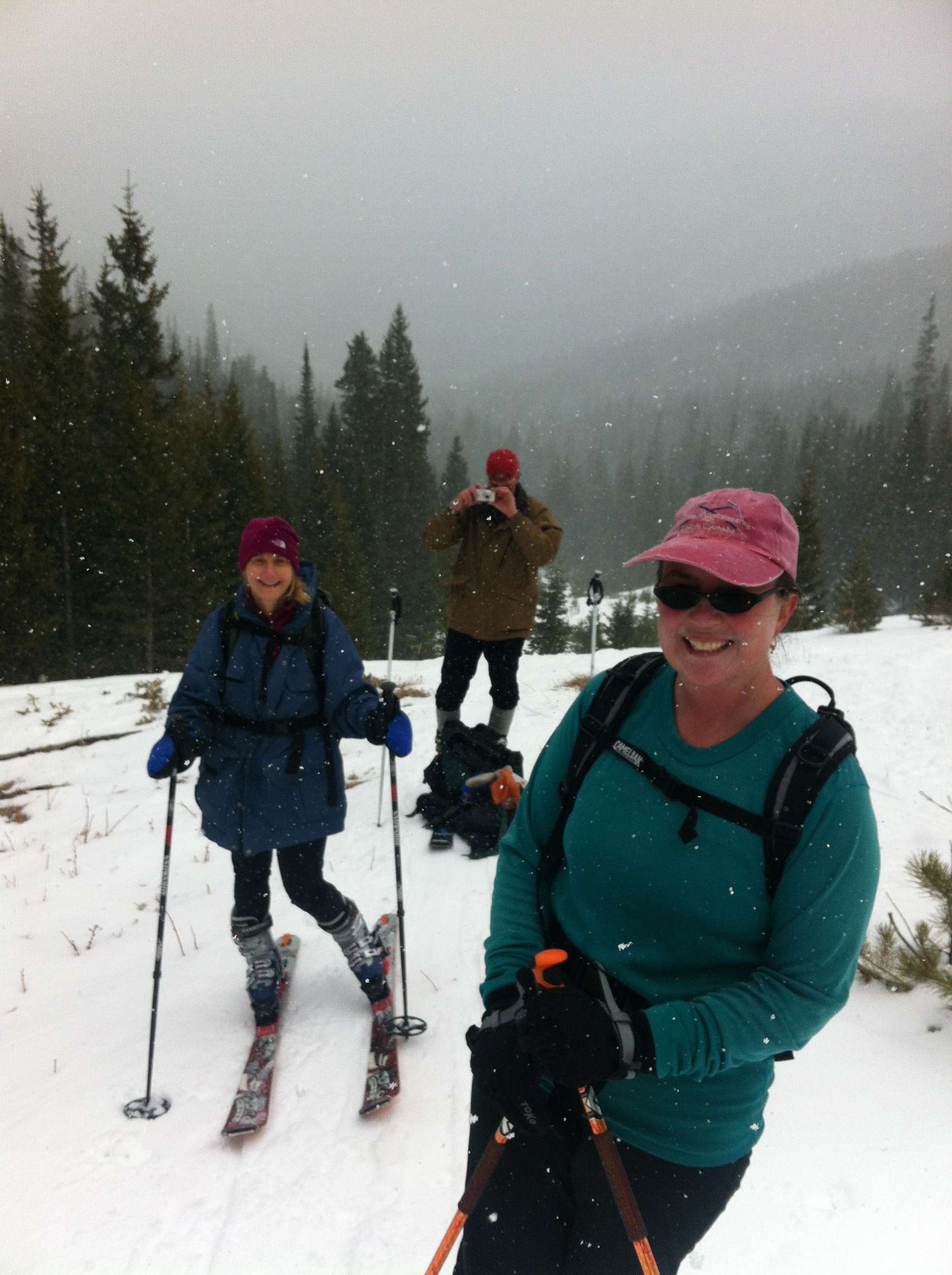
Shelly had her compass out and checked our direction the entire time. Also, if we hadn’t seen a blue diamond marker in a while we would retrace our steps to get on route. Best of all, the GPS app indicated exactly where we were at all times. In combination with a Trails Illustrated map that plotted the route, we could quite easily determine our position. On top of that, we actually did confirm our position periodically.
There was no one else out there and breaking trail the entire way made this feel like a long haul. A “long haul” falls somewhere between a “good day” and a “death march.” As we got to the Hogan Park area, a mile and a half long open meadow, the weather started to deteriorate until we were in a full-on blizzard, as seen on the right. By the way, click or tap on any picture to see a large version of it.
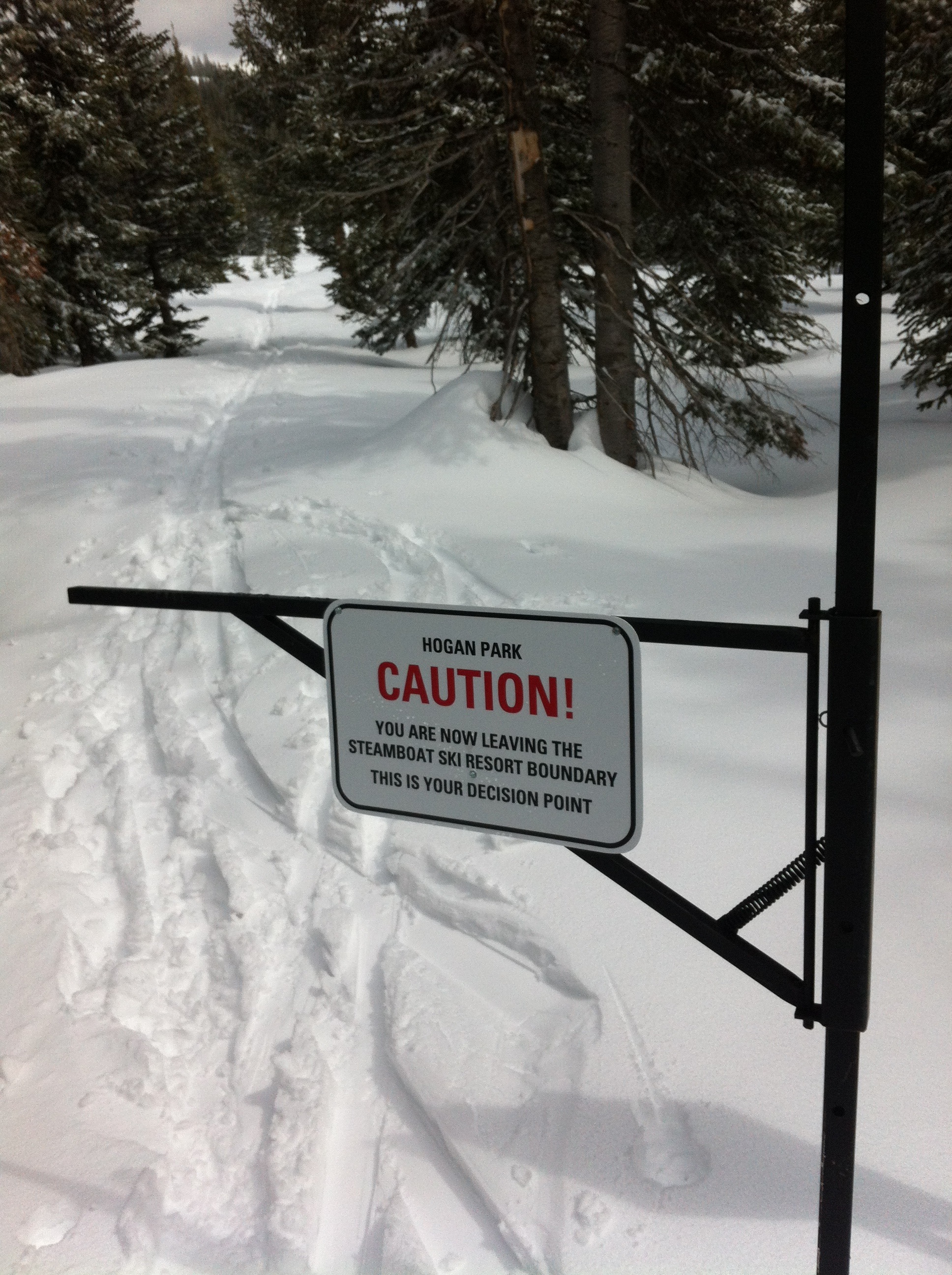 Anyway, after about four and a half hours we finally arrived at the outermost point of the Steamboat ski area. Yeah! The most difficult part was done. The ski area is roped and fenced in. This is meant to keep customers inside the area, not to keep us out. But there was an actual gate we needed to get through. Looking back, we read the sign on the left. The Ski Patrol does not want people to leave the area because this can cause them big headaches. If a customer goes missing, the Ski Patrol has to start searching for them at the end of the day. It’s always somewhat surprising that a sign needs to be put up warning you of your “decision point” to enter the forest, but there it is.
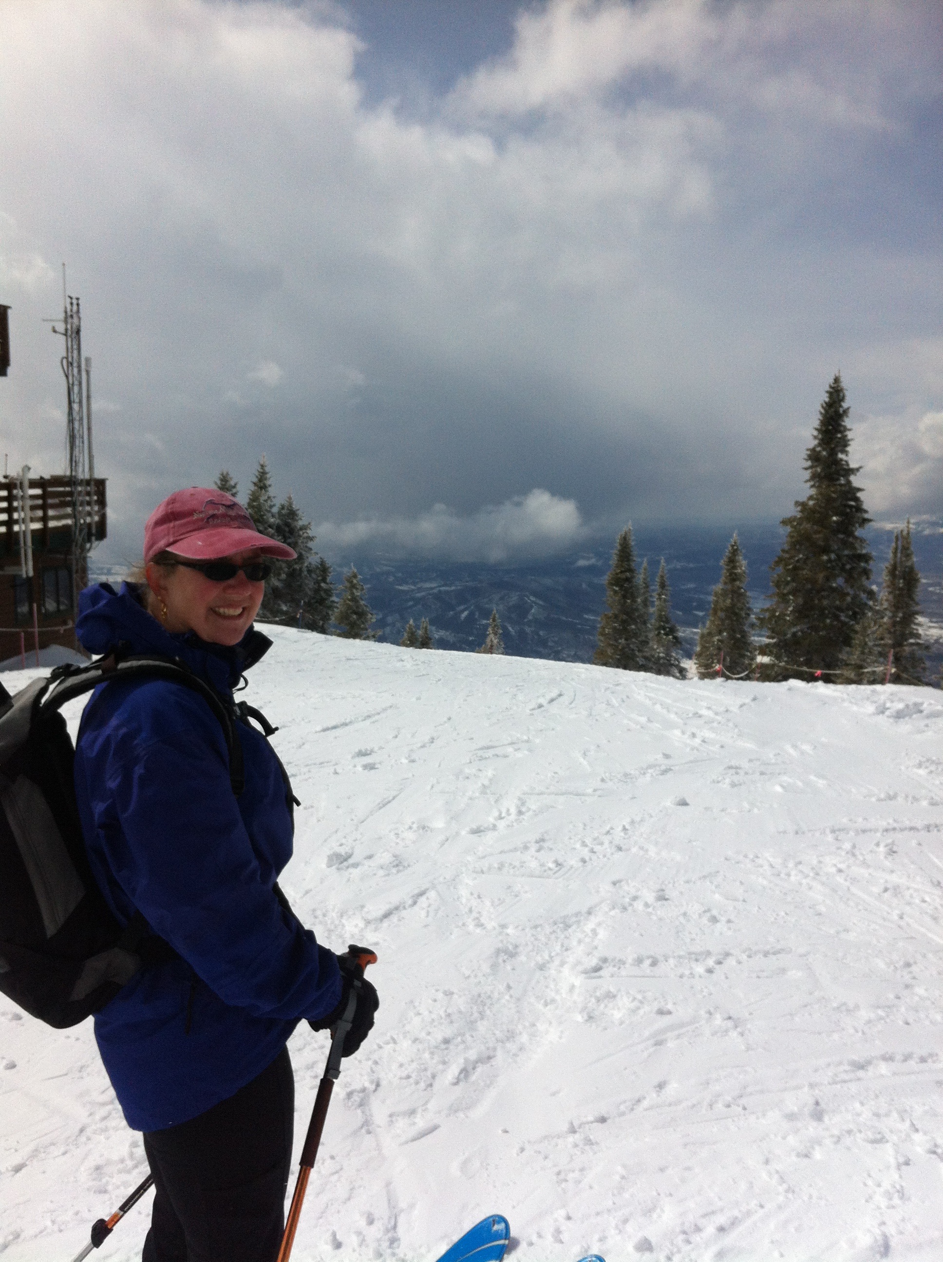
Anyway, the Morningside lift is right there. We adjusted our skis from touring mode to downhill mode and got on the lift. The operator asked how the trail was as we boarded. He could tell by our packs and lack of lift tickets that we were not downhillers but super-cool backcountry adventurers.
You might think at this point, with skiing down to the base being the only thing remaining, that navigation was over. You would be wrong. At the top of the lift, pictured on right, you are as far from the base as you can be within the ski area, and you have miles to go. There are several “dead ends” that force you to ride another lift to get out. Feeling shagged, we wanted to make this part as short as possible. In other words, navigation through the ski area is desired.
 It’s not quite the same difficulty, of course. We did this route a couple of years ago and it was the first time we had skied the downhill area. Last weekend was the second time. It is a huge and most excellent ski resort. We’ve owned our place in Steamboat for almost five years and have yet to buy a lift ticket. Funny how that works out, but really there are so many other skiing opportunities in the area and the lift tickets are very expensive with no chance of getting a discount.
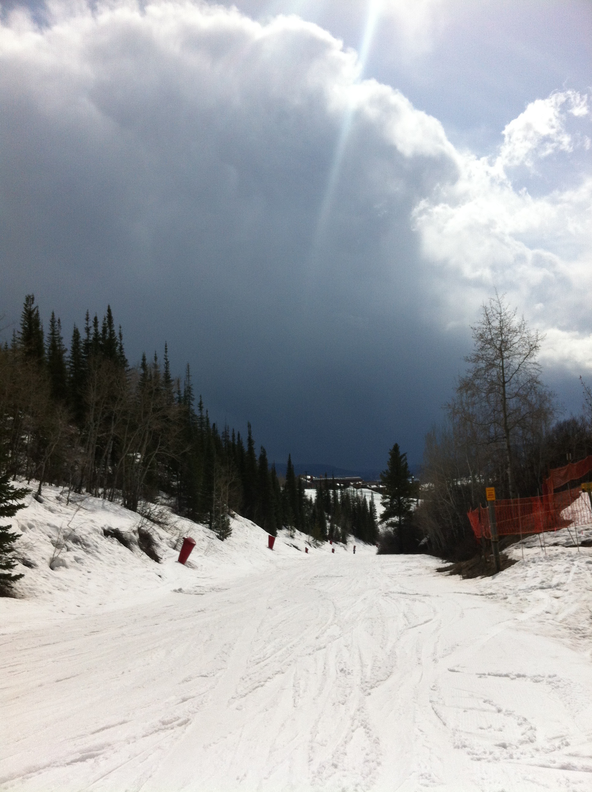
It takes a long time to ski down, especially if you quads are already burnt out. The snow at the top was fantastic but near the bottom it was thin slush. A big storm cloud loomed on the horizon, as you can see on the left. It looked like a summer thunderstorm.
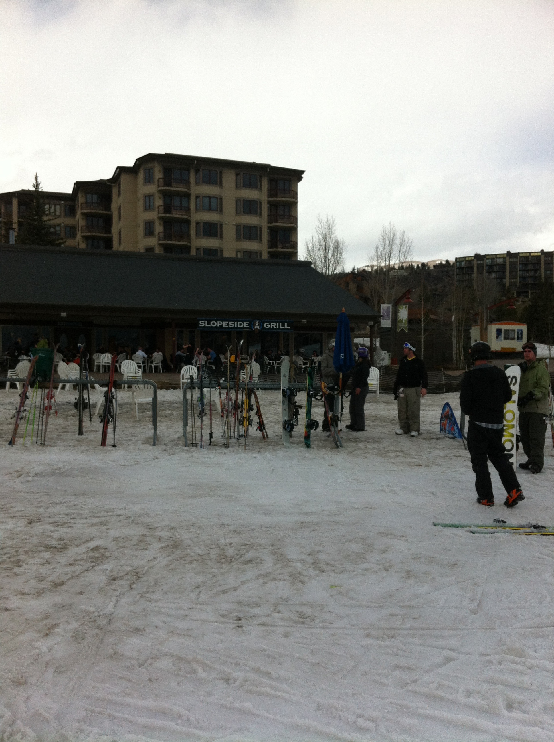
Finally at the end, we found the “pub at the end of the rainbow,” the Slopeside Grill. We stopped in for a celebratory beer… NOT! Unfortunately we still had to get the car from the pass! No problem, the beer could wait.
Posted in Trip Reports by Mark with comments disabled.
Hidden Valley Ski
Half Way Up. Left to Right, Melinda, Clint, Shelly.
Last weekend we drove up to Rocky Mountain National Park and did some backcountry skiing in Hidden Valley with our friends Melinda and Clint. This is an old ski area that closed in 1992 and was rehabilitated several years ago, meaning the Park Service demolished the old lifts and ski structures in the area to make it look more natural. I wrote about the re-opening of the area in my Insolent Guide. It turns out that you can read the chapter online here, courtesy of Google Books illegally ripping of my material and publishing it online. Thanks a lot, Google!
 Anyway, the excursion started out in warm temps under partly cloudy skies, and the snow conditions looked terrible. And the conditions were terrible, at first that is. Slushy and crusty. But this is spring and these were spring conditions, though it was more like May than March.
Once we got going things improved a bit and winter returned. The base of Hidden Valley is at 9,500 feet and the old ski runs climb up to 11,500 feet to a ridge line above treeline. As we climbed up, snow squalls rolled over the ridge and would briefly engulf us in a blizzard before giving way to more sunshine. The squalls increased in length until we reached Trail Ridge road.
The road is closed in winter, as are most roads in Colorado that rise above treeline. It is expensive to keep these roads open, they would require snow plowing at least twice a day whether it snows or not, due to the fact that 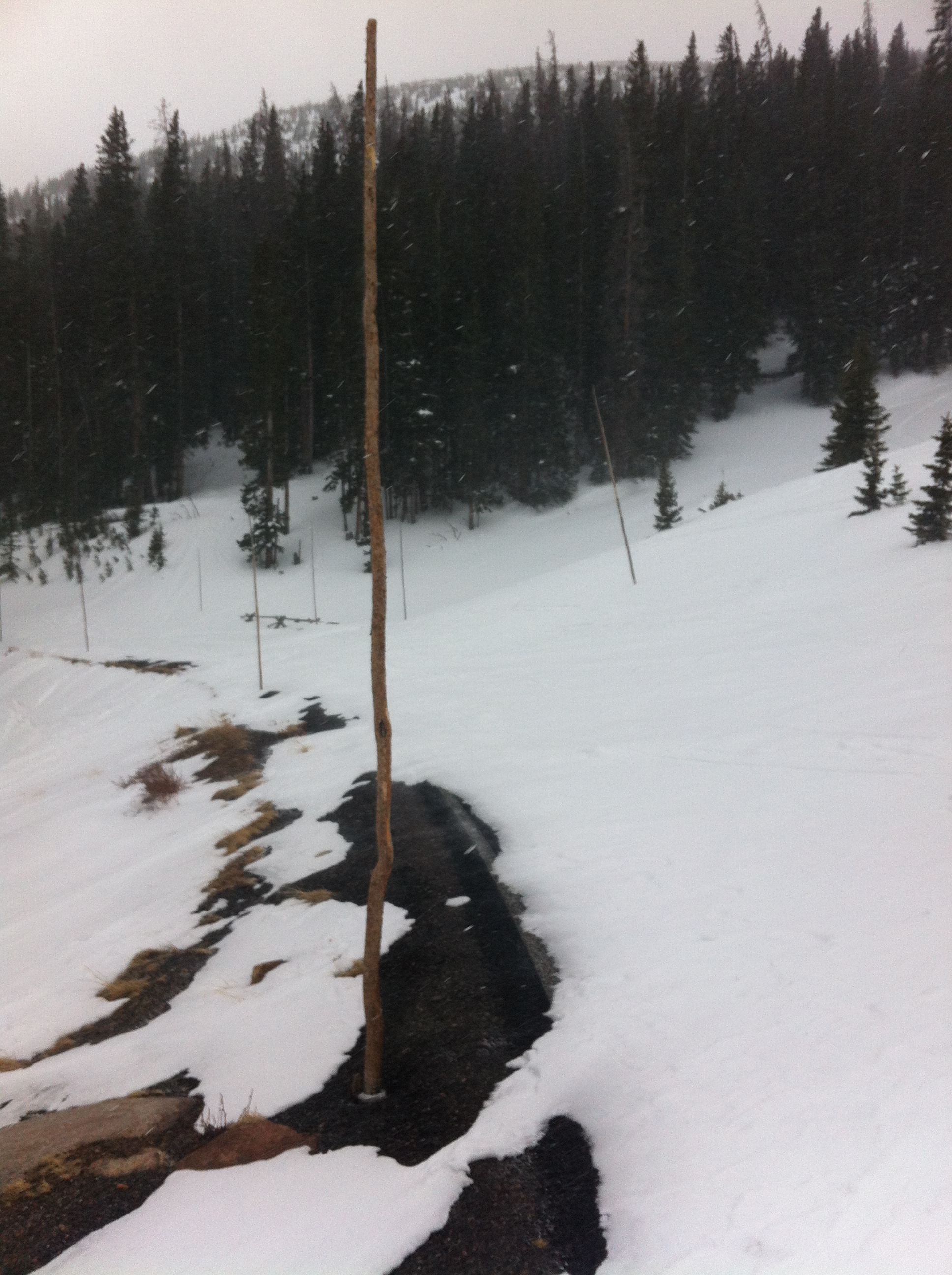 the wind blows constantly at this altitude, drifting over the unprotected roads. Trail Ridge road runs for many miles above treeline and the snow can build sometimes well over ten feet deep over the season.
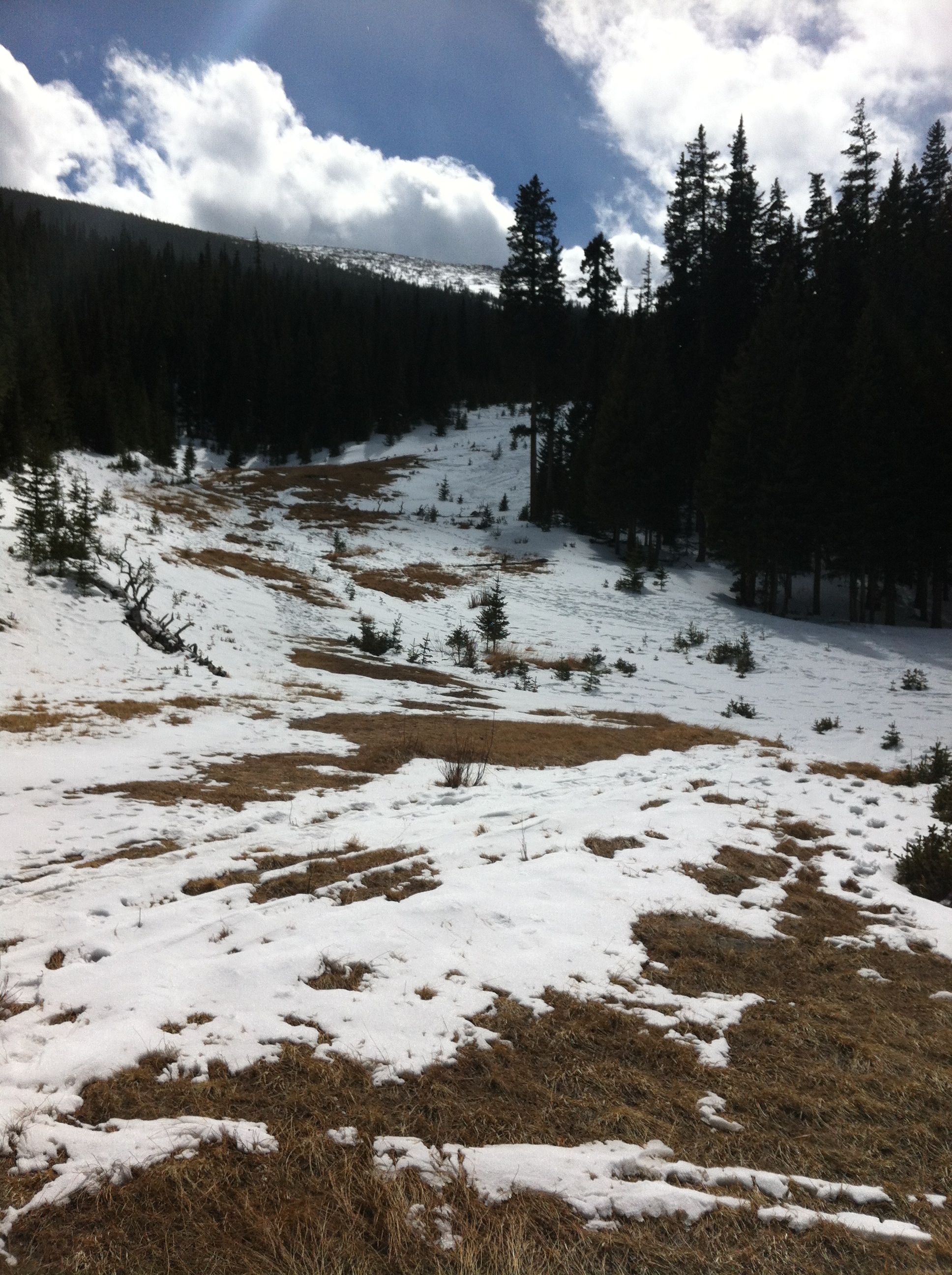
This year has been a low snow year as can be seen in the pictures. Trail Ridge road can be seen on the left. Notice the tall poles marking the edges of the roadway. These are used to guide the plows when the they open the road in the late spring, usually around Memorial Day. The poles are probably 12 feet tall so that they are visible in deep snow, but so far this year they’re unnecessary, the snow is so thin you can see the road pavement and the ground.
We got lucky and experienced a full-on blizzard just above the road crossing, which was about our high point. As you can see in the photo below, the snow was driving down hard, at least for a few minutes. The wind died down but the snow kept falling while we removed the skins from our skis and turned for an excellent downhill run. The snow conditions had improved because of the inch or so of new accumulation, but wow, the mountains could really use about 10 feet of new stuff. Not likely this year I guess.
Posted in Trip Reports by Mark with 1 comment.
Oregon Coast Hiking
Nehalem Bay from Neahkahnie Mountain
OK, last weekend I was in the ever-green Oregon Coast for some easy hiking. Being from Colorado, I am always impressed by the wet greenness of western Oregon. The coast itself is engrossingly wild, the shoreline is rocky with high cliffs that drop off into the ocean, interspersed with long flat white sand beaches. There is constant wave action that produces an ever-present low roar in the background as the breakers roll over. It is often cloudy with drizzle, and even a dusting of snow this time of year.
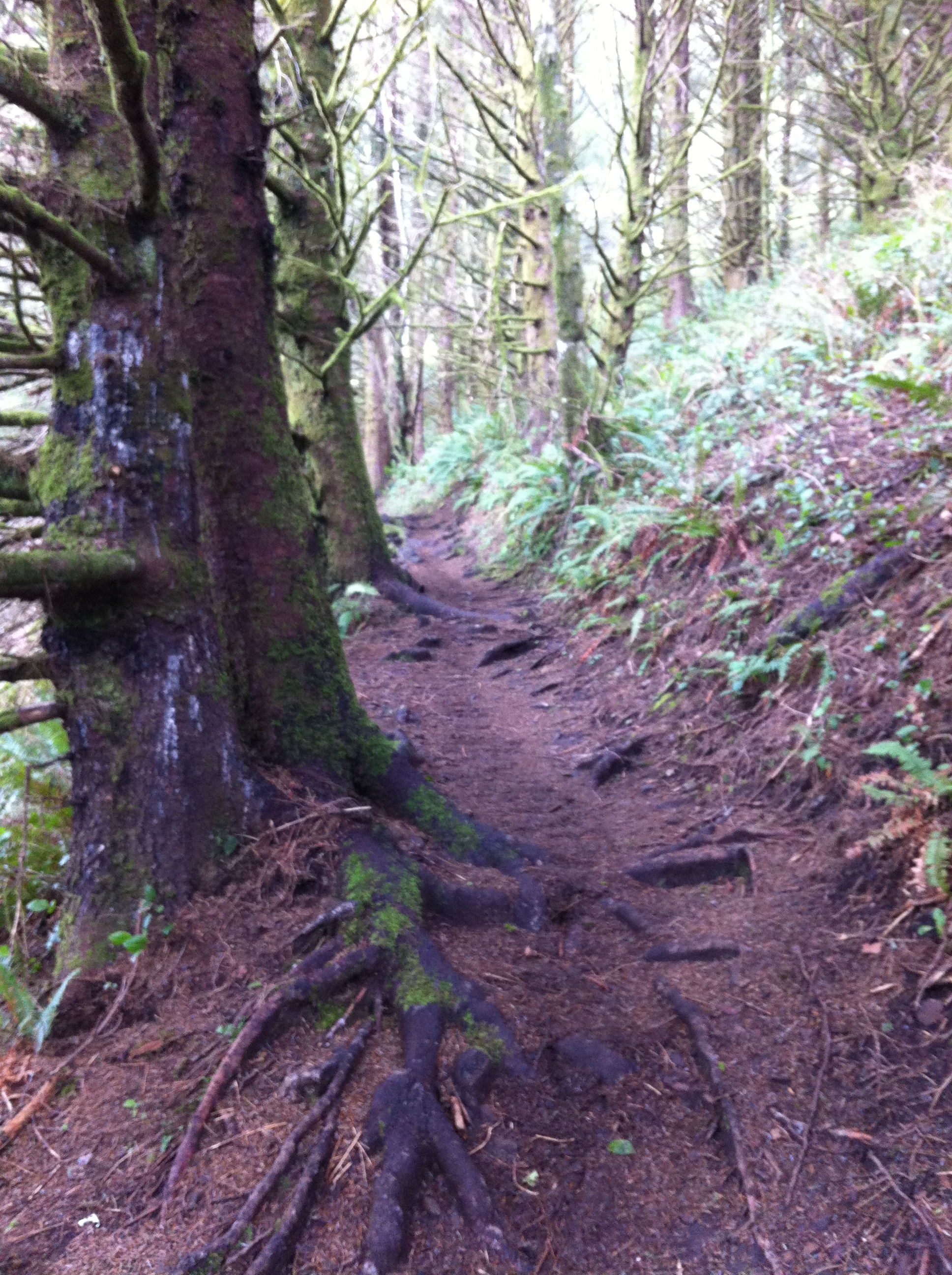 The trail starts just above the coast and switches back and forth as you climb up through the rainforest. The vegetation is a bit less dense than summer, but the moss and lichens are as thick as ever. And of course the occasional gigantic old growth fir tree that demands a hug. Tree Huggers were born here.
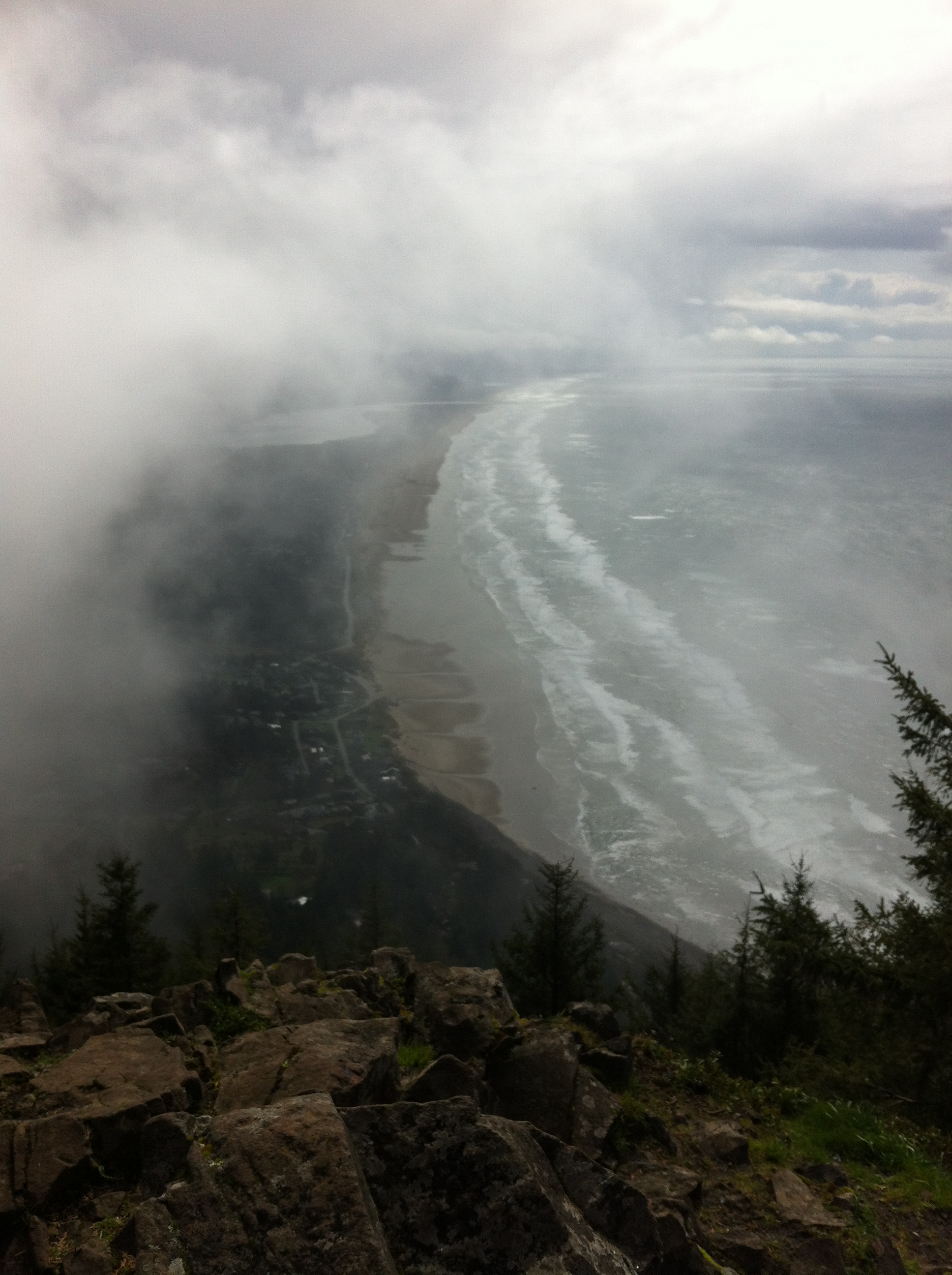
Neahkahnie is a Tillimook Indian word that means “place of the supreme deity,” possibly because of the summit views, 1600 feet above cliff faces dropping into the wild ocean and glimpses of the dense green forest through whisping fog.
There are also legends of Spanish treasure being buried on the mountain that date from the 1800s. If true, you can understand why it hasn’t been found. Hiking off the trail through thick underbrush looks impossible. Also, the mountain is currently part of an Oregon state park. Hopefully no more hunters try to dig pointless pits in this mountain, the real treasure is obvious from the summit.
After this hike I went down and walked along the beach outside the little town of Manzanita. It seemed to go for miles and the waves were mesmerizing, constantly approaching and breaking in different ways each time.
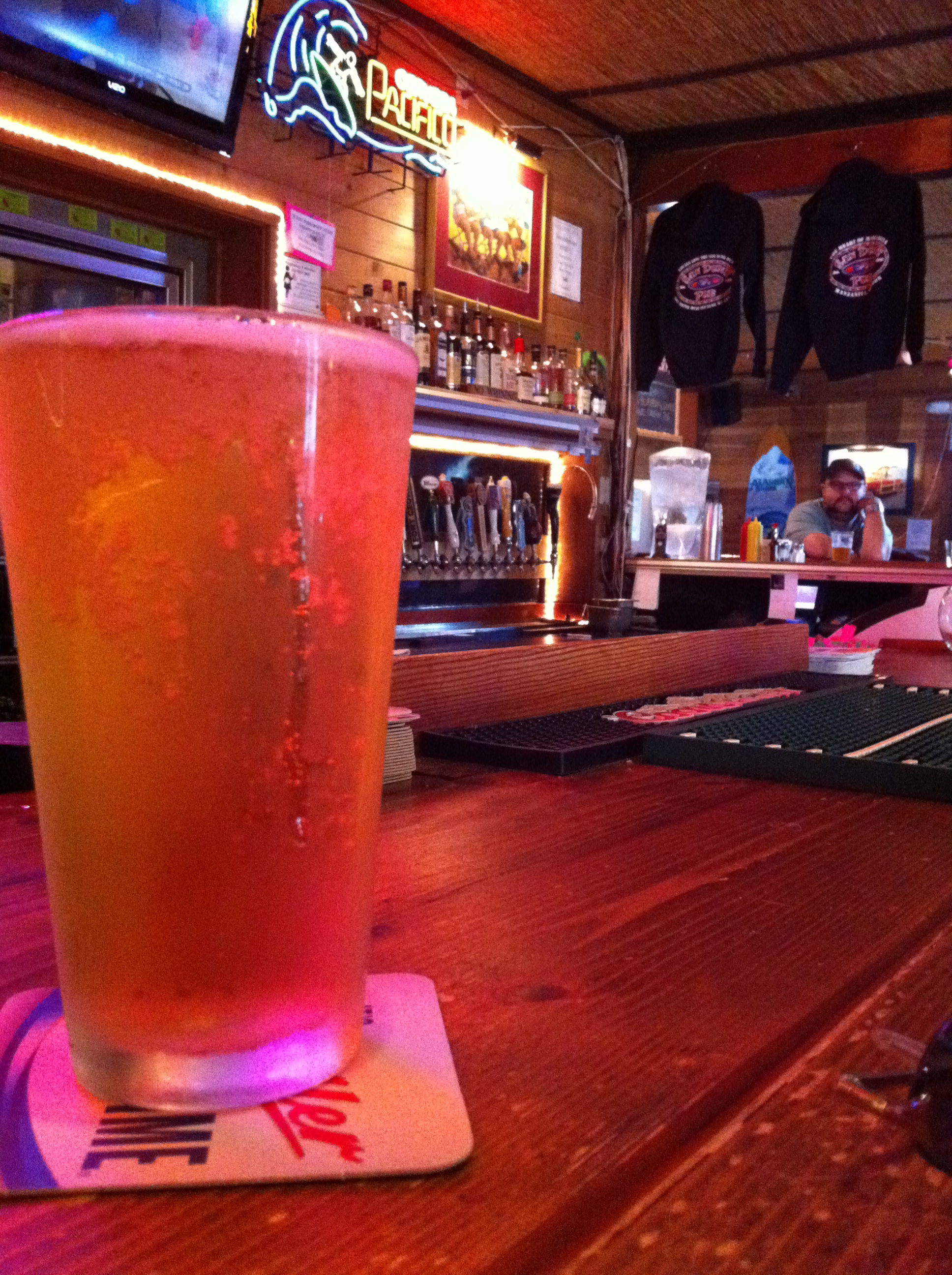
No trip is finished until you sample the local pub. This time it was the Sand Dune Pub. The variety and availability of local craft beer in Colorado is only outdone by Oregon. But since I am a beer drinking barbarian, I of course opted for an unmentionable brand light beer.
Cheers!
Posted in Trip Reports by Mark with comments disabled.
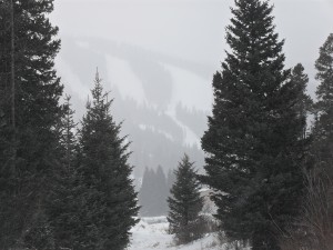
Steamboat in Feburary

Fireworks on Howelsen Hill, Steamboat Springs
We went up to Steamboat again last weekend and were surprised to find the town celebrating the 100th anniversary of their Winter Carnival. The town was packed with people for events that included the firework show seen above. It looked like fun but every time we go up there we spend as much time as we can in the mountains so we didn’t see much of the Carnival. As a matter of fact, when the fireworks started on Saturday we took advantage of the emptying restaurants to get seats without a wait. As soon as the fireworks were over the place was packed.
 Anyway, we found a lot of new snow and excellent backcountry conditions. All the northern mountains appeared to get a good amount this weekend but Steamboat got a dump of 10 inches on Saturday and even more on Sunday. We went up Emerald Peak, located just west of downtown, on Saturday. It was gray and breezy most of the day but this was good because with that gloomy sounding weather comes the snow. The trail up Emerald is groomed for about 2 miles. The snow is solid enough to walk on, and people do hike up this trail without snowshoes or skis, which I don’t quite understand, but there it is. It’s also a popular place to bring dogs.
As you climb up the hill you see this huge open field to your right. Apparently this area was 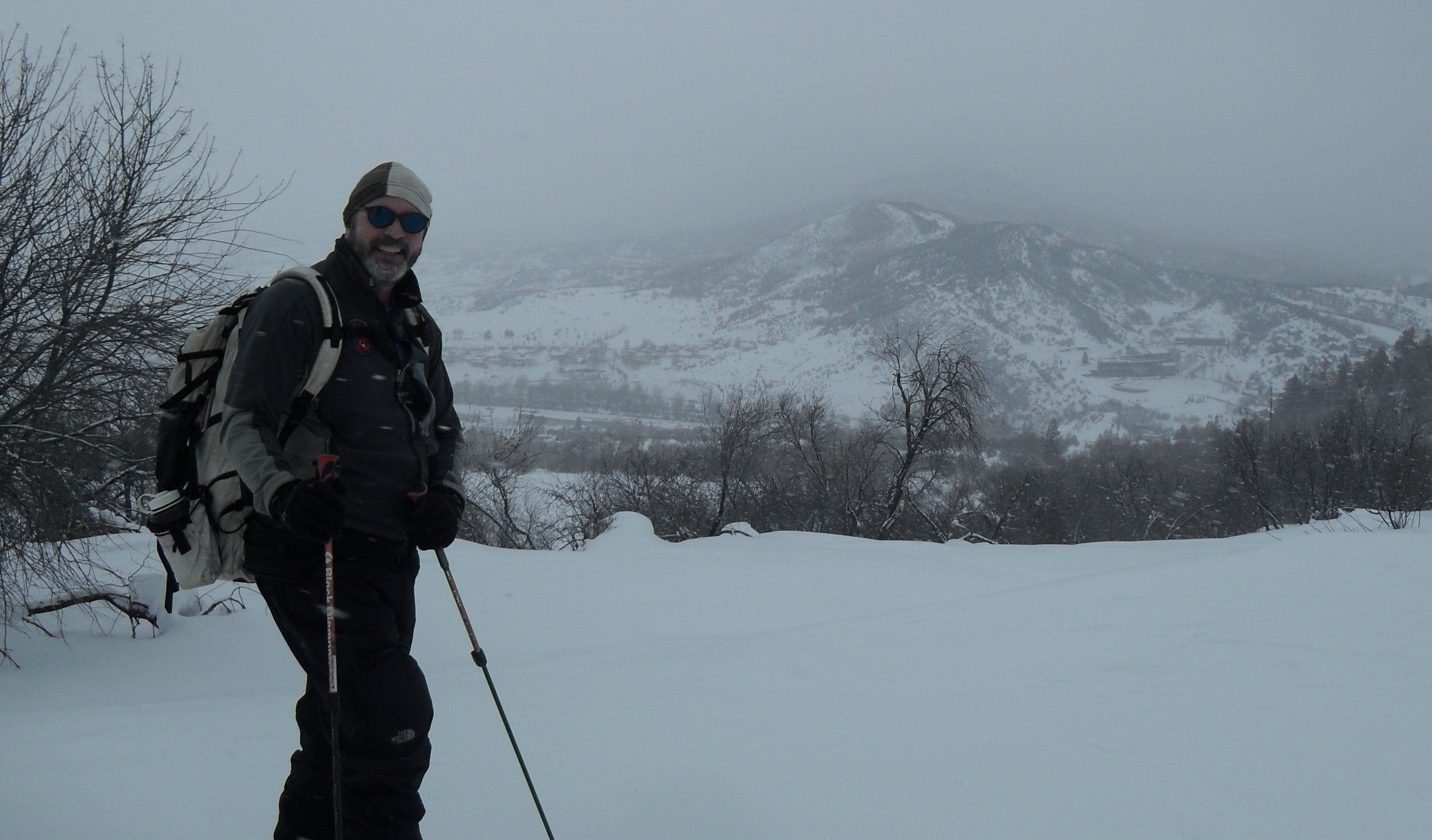 cleared for farming many decades ago but is now just a large open slope. Steamboat bought the property a couple years ago with help from the Colorado Lottery funds and is now turning it into a recreation area, Nordic skiing in winter and mountain biking in summer. We skied this field a couple of times but today we were sticking to the main track up the hill.
The groomed track ends at an overlook at the two mile mark. On a clear day you get a view of the beautiful Yampa valley, but not on Saturday. We were in the clouds and so continued on the non-groomed trail another half mile to the summit. Right on top there are several radio towers visible from all over the valley. It was too windy for a break there so we hung out in the trees and enjoyed our hot drinks before our long descent.
The conditions were excellent for the downhill, Shelly remarked that it was the easiest ski down she’s ever done on that track. Usually you have to work your legs hard all the way down to keep under control but this time it was very easy.

On Sunday we drove up to Columbine, a little village of cabins north of Steamboat. Lots of snow there, like ten feet. They seem to be in a little geographic area that just tends to catch the snow. In the past a big group of us would rent out several of these cabins over the long Thanksgiving weekend hoping to ski some early season snow. We reasoned that if there was skiable snow in November, it would be either here or at Wolf Creek pass. It’s a cool little place where you can ski right out your door into the vast wilderness beyond.
 The cabins allow parking for cross country skiers, a good thing because their was so much snow the sides of the road were plowed up walls 5 feet high and there was no way to park there. Hahn’s Peak is an 11,500 foot mountain just east of the cabins and that was our destination. The first part of the route was packed down by snowmobile tracks which eventually ended. We then broke trail for a while. It was snowing on us all the way and very cold, around 20 degrees. The route goes all the way to the summit of Hahn’s Peak giving you a fantastic view (on a clear day). I describe this ski plus another one near the Columbine cabins in my Insolent Guide. The area is a reasonable drive from the front range cities and has the best snow in the state.
The snow was kind of funky on Sunday making the ascent a bit more difficult. Added to the cold and trail breaking, we decided to turn around after about two hours. And because it was so cold, we got going downhill right away without a rest. It was a good glide down, we got a few turns in fresh powder slopes through a grove of aspen. Back to the car and the drive back to Steamboat.
On this trip we didn’t get to Strawberry hot springs but did of course get in the hot tub at our place. It’s great to soak in the hot water and drink a Coors Lite while it snows on you. To be clear, I had a Coors Lite, Shelly had some wine. I would never accuse someone other than myself of drinking such a beer even if I had photographic evidence to the contrary.
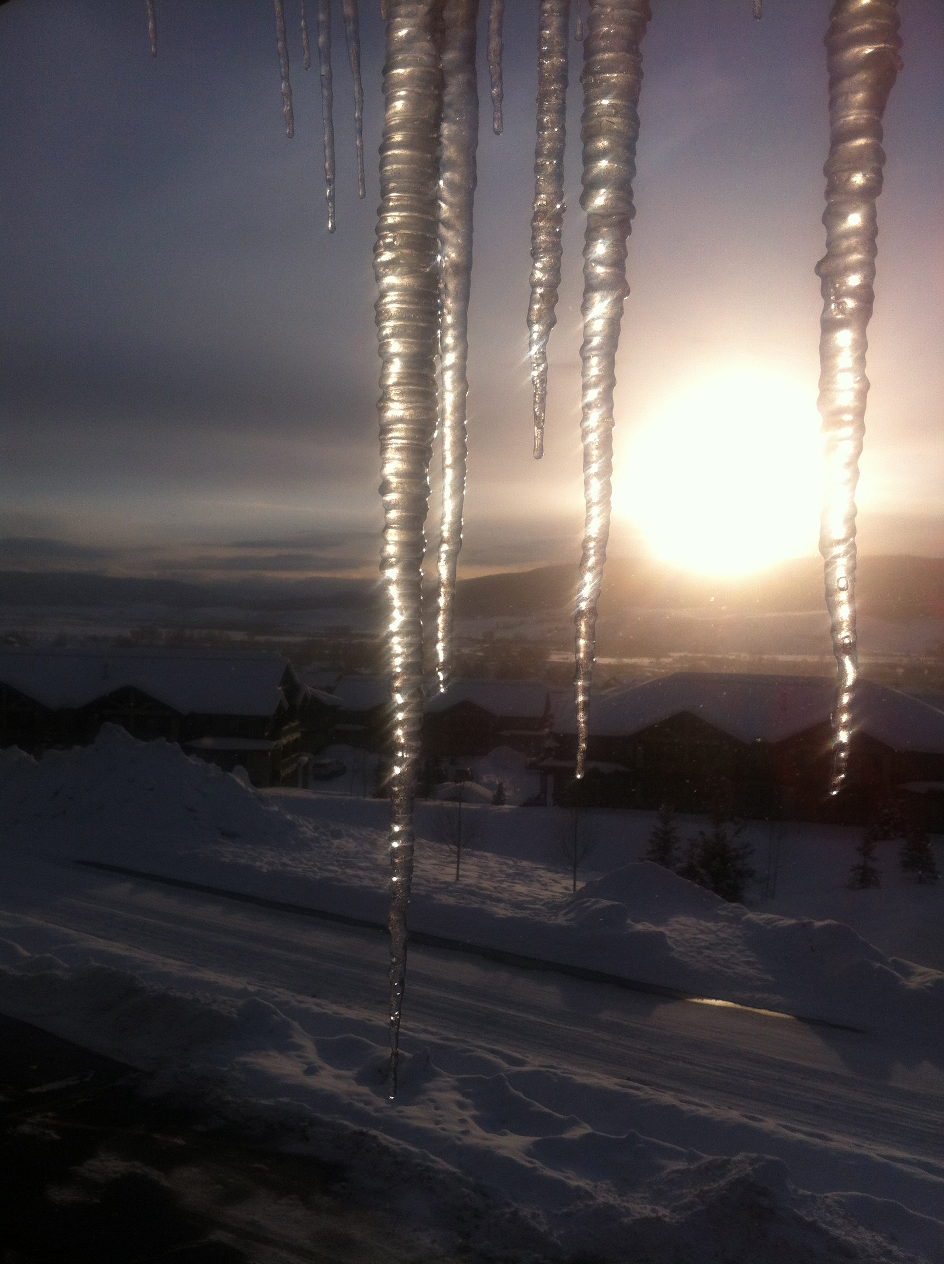
We watched the sun go down but not before I caught the scene of the sun through icicles from our room balcony. The end of another great weekend in Steamboat!
Posted in Trip Reports by Mark with comments disabled.
Steamboat Springs in January
Shelly Tele
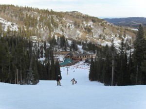
Last weekend we went up to Steamboat for a couple days of skiing. Believe it or not, we’ve never skied in the resort itself. Well, that’s not exactly true, the final leg of a long and difficult backcountry ski trip called the Hogan Park tour we did a couple years ago ends at a remote back side ski lift. We hitched a ride up the lift and skied the resort slopes down to the base area. Not bad actually except we we too tired at that point to really enjoy the slopes.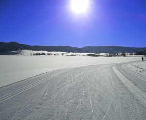
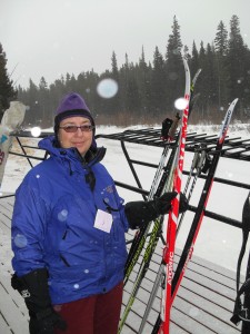
On Saturday we hit the Lake Catamount Touring Center. This is an area of groomed Nordic trails just south of Steamboat. There are several miles of skate skiing trails on Lake Catamount and the surrounding hills. By the time we got there the temps had climbed to about 20 degrees and without any wind this is very comfortable, especially for a workout. The sky was cloud free as you can see in the pic to the right. It shows a section of the groomed track. It’s pretty flat here but that’s the kind of thing you want for skate skiing. It gets much more difficult when you add in the hilly sections. This part of the track is on the lake itself, there are other parts that go up the hillsides around the lake. We were out for about 2 hours, enough to get a pretty good workout but not too exhausting for what we planned for the next day.
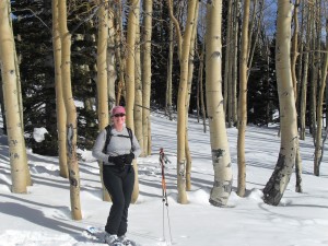
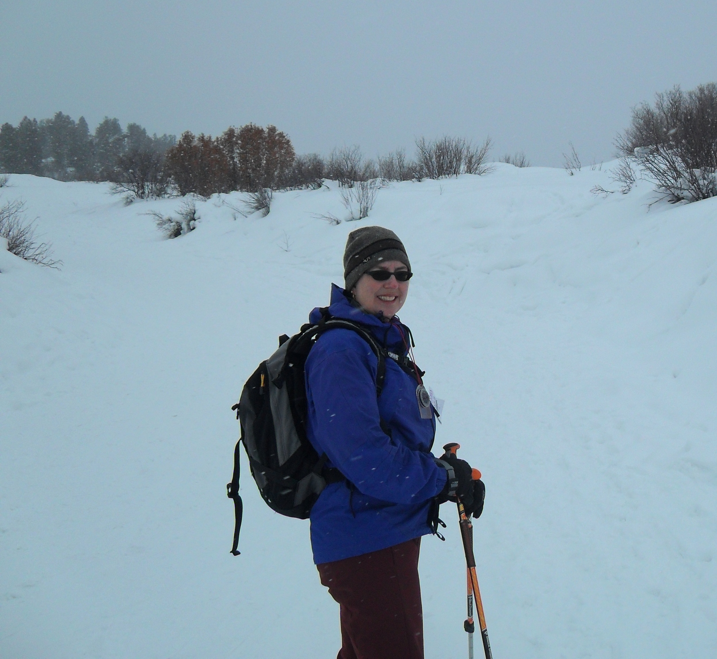
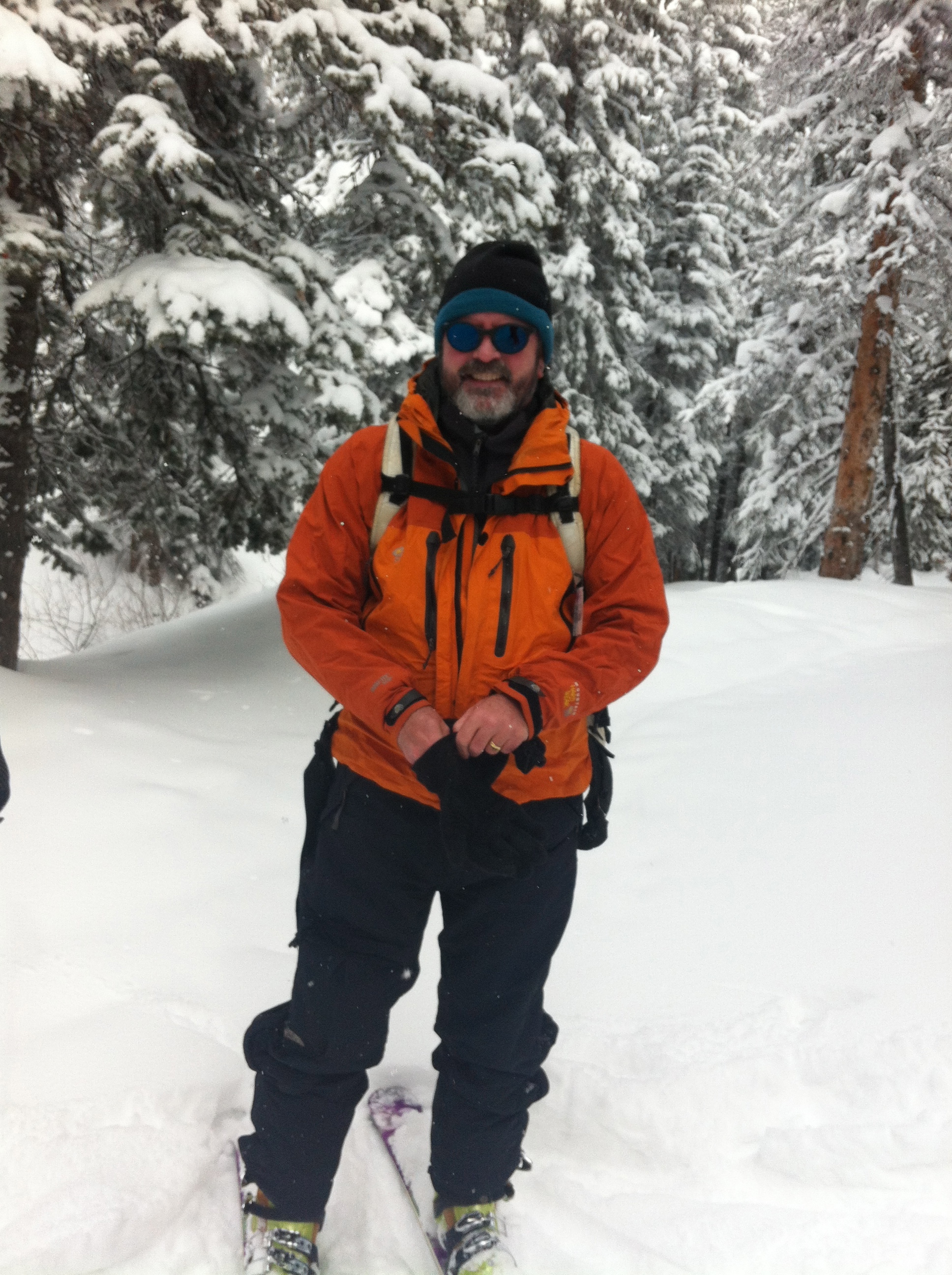
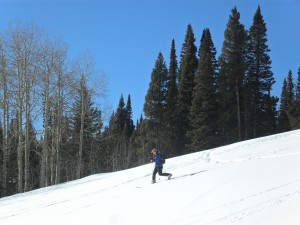
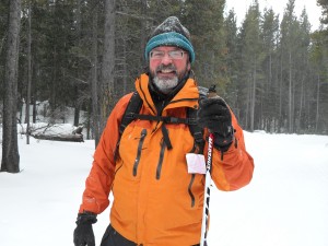
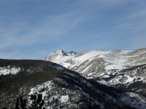
On Sunday we drove up to Rabbit Ears Pass, a few miles southeast of town, to do some backcountry ski touring. Though it’s been a low snow year, this area is a snow magnet and had plenty of depth for some great skiing. There are several long loops you can tour through the trees and meadows on the pass. Rabbit Ears is a unique area, most of the routes are only useable in winter. In the summer this area consists of many large mosquito-infested bogs with no useable hiking trails. But in winter the bogs are frozen and covered with several, sometimes dozens of feet of snow. The US Forest Service maintains the winter routes that are marked with blue-diamonds attached to trees or on stand-alone bamboo poles. Following these diamonds, and the ski tracks in front of you, is easy on calm, blue-sky days as Sunday. But this area is notorious for heavy snow, whiteouts and wind that can quickly erase the tracks on the snow in front of you. It’s easy to get off route in a whiteout if you aren’t paying attention to the blue diamonds
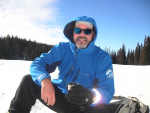 . That wasn’t a problem last weekend though as you can see from the pics of Shelly in front of aspen above and myself on the right resting with a hot drink. I was testing out a new jacket. It worked very well. There was a bit of breeze coming from my right but I was very comfortable without a heavier jacket.
The route we took had the impressively imaginative name West Summit Loop A. I’ll go into further detail in a later post using a Guide category in the blog. I’m planning on adding a bunch of Steamboat area ski guides on this blog as I haven’t found a good summary anywhere. It might turn into a new guide book, who knows?
 We spent about three hours on the pass. We got some turns in on a couple of slopes. That’s Shelly at the top of this post on the last long slope. The snow there was somewhat crusty and difficult to turn, but overall this was the only complaint. Rabbit Ears is in far better condition now than anything on the Front Range.
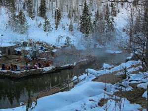
No trip to Steamboat is complete without a visit to Strawberry Hot Springs (left). Hanging out in the steaming water while surrounded by snow in minus 5 degree air is something everyone should experience. This is a natural hot spring just north of Steamboat that bubbles out at 150 degrees. The resort built up some channels to capture this water and mix it with frigid water coming down Mad Creek in several big pools that keeps the temperature at a comfortable temperature just over 100 degrees. It costs $10 per person but well worth the price to soak away your muscle soreness.
And of course at the end of it all you need refreshments! We went to a relatively new restaurant and bar called The Laundry, a great little bar on the edge of town. A good place to meet all kinds of people from artists to society dropouts (seated on either side of us that night).

Posted in Trip Reports by Mark with comments disabled.
Nordic Skiing at Eldora
View of the frontside downhill runs from the edgeof the Nordic area.
On Sunday Shelly and I went up to check out the tracks around Eldora’s Nordic center. This is an area of cross country ski trails that are maintained by the Eldora ski resort. Lots of ski resorts in Colorado have these areas. You might ask, why go to a pay area when there are literally hundreds of miles of free terrain to back country ski near Boulder? Well, we went up to skate ski and that requires a groomed trail. Skate skiing is just what it sounds like, you propel yourself along a trail using a skating motion, like ice skating on skis. The skis are designed to optimize this motion and you can get an excellent workout in the wintry mountains this way.

The Stadium
The first thing we noticed was the cold! It was about zero degrees Fahrenheit, cold enough that we both kept on a couple of layers even during the workout. That’s rare, especially for someone like me who, during a workout tends to generate enough heat to boil water.The second thing was that even though we had gotten some new snow, it wasn’t enough to make up for the very thin cover. Many of the Nordic tracks were closed due to lack of sufficient snow and even the trails that were open had many rock hazards. This is a problem, if you ski over a rock you tend to stop immediately resulting in a faceplant. Check out the pic of The Stadium, an oval field you can normally run laps around. You can see the grass poking out. This is usually a completely white snowfield this time of year.
So…. The next problem was that we couldn’t get any glide! Either because of the cold or snow conditions, or both, our skis were too sticky to skate without a tremendous effort. We overheard complaints from the few others out there on skate skis as well. This would have been a better classic ski day, we decided, but we didn’t bring our other skis and had to “suffer” with what we had. I was OK with just being outside as you might see. Shelly was not as enthusiastic but wanted a workout. I took a pic just outside the Nordic Center building. The white spots are close-up snow flakes. She is “enjoying” the cold. As is usually the case with these kinds of outings, we’ll suffer with poor conditions for a while before giving up. And it was about an hour. Really, it’s part of the adventure, right?
On the upside, Shelly discovered the perfect recipe for hot chocolate. We both agreed that it was the best we’d ever had and made up for a lot. We drank most of it back in the heated car!
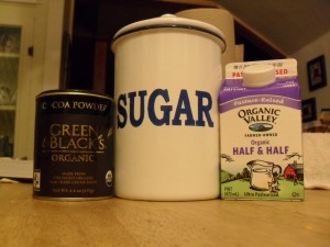
Two cups boiling water
Three tablespoons Green and Black’s powdered cocoa
One tablespoon raw sugar
Some Half-n-Half
Well, not all adventures turn out great but live and learn, next time we’ll bring more ski options and there’s always next week!
Posted in Trip Reports by Mark with comments disabled.
Eldora Ski

Eldora is a small downhill ski “resort” in the mountains above Boulder, Colorado. Hardcore skiers like to dis Eldora, it is much smaller than the major resorts in Colorado and lacks the amenities of those big resorts. But it does have two things going for it: Convenience to Boulder, only about thirty minutes away with no I-70 traffic madness, and the fact that most skiers are not that “extreme” and have as much fun there as anywhere.
I drove up last Sunday afternoon to end my weekend on the slopes. This is a perfect time to ski as the crowds are thinning by this time and close-in parking is opening up. Yeah, I used to get up at zero-dark-thirty to join the frenetic crowd and still only got a half day of “real” skiing. The Sunday afternoon approach is much more relaxed and enjoyable, and no long lift lines. No lift lines at all actually.
It was comfortably warm Sunday, like spring skiing, and the infamous wind was not blowing. With no lift lines I found myself on the summit in no time. A fast descent on somewhat below average snow got me to the base of one of the backside lifts.
![]()
It was nearly abandoned with no customers waiting and one lift operator. On the ride up I saw only a few hints of skiers (photo above). Another fast ski down on my first day of downhill skiing this year got me to the base of the Corona lift. Despite warm temps and no snowfall for a week and a half, the snow was OK with a moderate number of icy patches. I rode up the Corona lift, this is the edge of the ski area.
From the Corona lift you get a great view of the Arapaho peaks, a popular hike or winter climb I wrote about here. They can also be dangerous of course and are an infamous location for Rocky Mountain Rescue missions. They look very peaceful today, though.
Though I prefer backcountry skiing, one thing I always enjoyed about ski resorts besides the fun of many downhill runs in a row is the way you can be in the outdoors in relative comfort. Despite all the trappings of civilization that go with resort skiing, you are still outside in the mountain wilderness. You can smell the pine forest, feel the cold air on your skin, the sharp breaths, and take in the beautiful snow-covered surroundings. It’s not a simple appreciation of nature, you become part if it. You understand what it means to be into it.
Being the first downhill ski day of the year and the lack of crowds to enforce breaks between runs, my quads were soon burning.
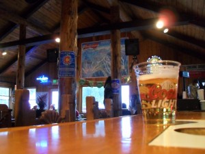
I took one run beyond my limit (feel the burn!) and spotted the lodge below. It was about 4:00 pm, man it starts getting dark early this time of year. And it got colder. Definitely time to call it quits. Of course, no ski day is complete without a visit to the local watering hole. The bar at Eldora is quite rustic but cozy. The greatest thing about it is you can order a simple hot dog and it’s not even a kids menu item! Of course there are better restaurant choices in Nederland, but that’s for another report.
Cheers!
Posted in Trip Reports by Mark with comments disabled.